

I heard about the hair-raising Apache Trail first from a customer at the hot air balloon office saying that she had, “done crazy stuff like this before, like take her friend along the Apache Trail, and she vomited, but we made it through!” I thought, “now this sounds like my kind of adventure!” After further investigation I came across a few notes about it being the, “best road to test your vehicle and your stamina,” and immediately knew that this must be the trail for us. But maybe .. best road to test out your mini van and make sure you know how to replace a tire or bring enough water – like most long roads in the Southwest where there often isn’t a gas station for miles, would be more appropriate as far as capability tests and adventure seekers.
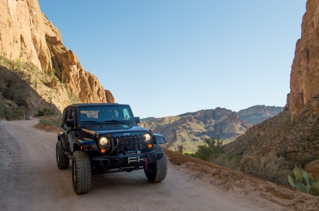
A description on DangerousRoads.org read, “with wheels sometimes hanging above the precipice.” Not so. This twisty drive begins just past Canyon Lake after you pass through a neat historic stop at Tortilla Flat and the Superstition Saloon. Eventually the pavement ends at mile marker 222 on Highway 88 where there is a restroom and scenic overlook just before and your journey begins.
Because in July in the desert (July and August are Arizona’s most dangerously hot months) a breakdown or flat tire could mean strenuous exertion and severe water loss in 100+ degree heat, we brought lots of extra water and some extra food (in case we meandered off the trail and got lost). My first aid kit is standard on any of my outdoor adventures. You never know what can happen. If you did get a flat tire due to a nail from somebody’s burn pile, and either didn’t have a spare, or couldn’t get your spare on, you would be stuck there until the next car happened along. But this is true for most outdoor adventures.
We saw maybe 10-20 vehicles going the opposite direction of us along the trail, mostly SUVs, trucks and one off-road capable motorcycle (i.e. not a Harley). We were passed by two cars, one truck and one or two SUV which may have had some tight turns in the smaller sections and I imagine that there are more vehicles in the winter time making some of the one-way sections of the twisty part scarier than they were for us. The road is narrow enough in many places that we had to pull off to the mountain side to allow the other vehicle to go through.
We happened along a young couple in a Honda Ridgeline who found themselves with a flat tire after camping out near the beginning of the trail that night. They were not able to get the lug nut off to put on their spare and flagged us down to see if we could help. Without shade and enough water, even this simple task can turn into a very hot affair. Brent pulled the flat tire, they put on their spare and head on their way.
I wasn’t expecting rock crawling, but the most jeep-flex worthy activity we played on we found ourselves by venturing to a little hill off of the main, well-maintained, dirt road.
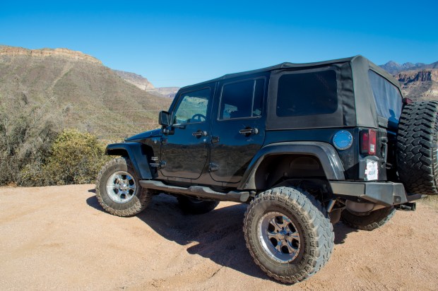
We drove off the main road to find an area to make the Jeep do some work.
Iconic is a much better word for this drive. Perhaps we are particularly seasoned adventurers and accustomed to more “death defying thrills” (like hiking to the Flat Iron in the Superstitions!) and used to this sort of thing. During the few downhill hairpin turns, there was just a thin guardrail right and we put the jeep in 4-low and cruised leisurely along the trail, but unless you are afraid of heights, which Brent is (though he wasn’t phased) it’s not scary.
You’ll begin your drive in Apache Junction, Arizona. I would even recommend starting at the Goldfield Ghost Town. The next ten miles to Canyon Lake is well paved and gives you just a taste of the beautiful scenery you are about to adventure through. You’ll go by the Canyon Lake Campground and lake where I do not recommend stopping to camp, but they do offer a lakeside restaurant and a steamboat ride.
I say this because our stay at the Canyon Lake Campground was easily the worst experience I have ever encountered at a camp site and I was quickly reminded why I do not stay at shared campgrounds very often. But the temptation of sleeping next to a lake and the gentle lapping of waves on the shore lured us in. There was no gentle lapping, and because our site was full of trash and because the trash bins themselves for the grounds were overflowing, there was a swarm of bees hovering around the trash can area. And what I later realized was likely a sugar high from their regular soda consumption, the jacked up bees hovered around our morning breakfast, coffee, and dinner and buzzed us regularly. One truck down the row of tightly crammed tent sites blared loud music over his speaker (yes just one, one side was already blown out) for most of the sunset, and the site across from us allowed their chihuahua to bark obsessively at every passerby for quite some time. The group directly next to us slept split between a small tent, the truck bed, and inside of their truck. It was a long night. I highly doubt anyone in that camp ground was out to “experience nature” quite the same way that we were.
We couldn’t run away fast enough in the morning.
We continued our search for what Dangerous Roads article referred to:
“A traveler on this road must be experienced and completely devoted to safe, slow and obstacle-conscious driving to deter danger. Some passengers may think that the drive up is a bit easier than the drive back. On the way up, although the turns are tight and the road is narrow, at least you have the mountain on your side not the cliff. Obviously, if you turn around and go back the way you came, your return trip might be a bit more harrowing. Note to the driver: keep your eyes on the road, not the scenery. “
This must really only refer to the first part of the trail leaving Canyon Lake and heading towards Roosevelt. Sure, don’t get distracted and drive off the cliffside, the rail won’t stop you. This iconic Southwest historical drive led the way for stagecoaches through the Superstitions for years was a wonderfully scenic and historical experience.
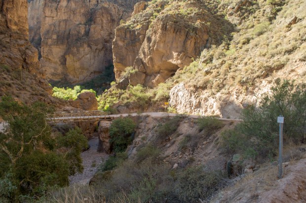
Narrow bridge
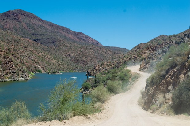
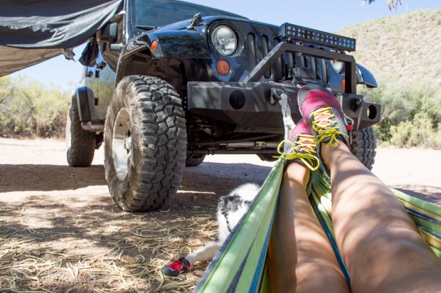
While still hoping for some excitement about halfway along the trail we turned off on a separate trail towards the Salt River down Davis Wash to see where it might lead and stopped for an early lunch along the water. It was nearing 100 degrees by 11am and we stopped under a shady tree at a quiet boat launch area where we could hang up the hammock and get our toes wet for a bit. (You’ll need a daily Tonto Pass to park here).
This would have been a much better campsite than the night before. We hadn’t been able to have much of a breakfast because we were in such a hurry to get away from the campsite and the bee swarm so we were anxious for some real food.
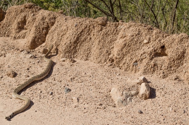
Back on the trail again, we were lucky enough to come across one of the desert’s most deadly inhabitants known as the Western Diamondback Rattlesnake. I was glad for my camera’s zoom for this one, the Diamondback is a pit viper classified as one of the most venomous snakes in North America. And while always exciting to see one of my favorite state’s most iconic wild creatures, they are one of the most aggressive rattlesnake types and can grow up to seven feet or more and have an impressive strike distance. His well defined jaw, triangular shaped head and spotted/striped tail were clear indicators of just which snake he was and to steer clear. Contrary to common belief, they don’t rattle unless threatened, so my last few encounters with them have been met with silence and a relaxed skidaddle off the pathway. Not helpful when you are trying to avoid them on a hiking path.
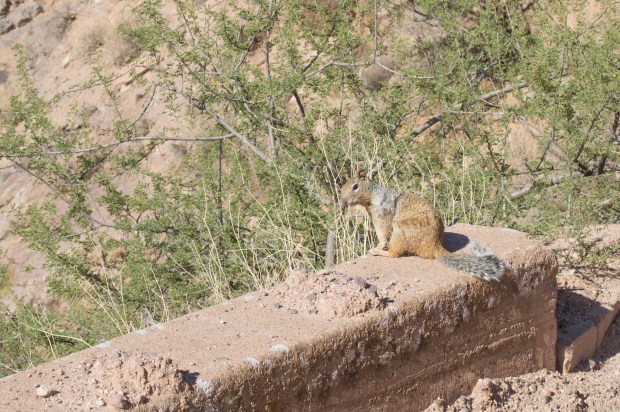
We found another, much less deadly creature not too far down the road, curious to see what we were up to and clearly no stranger to cars.
The area is also home to a large population of Desert Bighorn Sheep and Javelina, rare sightings of mountain lions, the occasional bobcat and even bears live in the area but are not at all common.
We followed the trail until the road became paved again right at the Roosevelt Dam, then turned right on Highway 188 towards Globe, then back down to Phoenix on Highway 60 for a round trip of about 126 miles. The final stretch off the Apache Trail from Roosevelt to Highway 60 and back is all paved highway with some neat and historic stops along the way through Superior.

So while I greatly recommend this gorgeous drive Highway 88, or Arizona’s Apache Trail for the scenic aspect, it’s not for those hoping to check their off-roading capabilities. For anyone used to off-roading in any capacity it is a simple, dirt trail with no real obstacles. For those who are not accustomed to driving off pavement, this could be true test of your vehicle maneuvering and ability to watch the road. It is not recommended for small or classy cars. But I do believe there are some great off-road trails that stem from the Apache Trail that I need to explore and report back on!
I wouldn’t drive my prized Mini Cooper S on the wash-board road, or a rental or RV (too big!) but your heavier built standard Subaru, small SUV, mini van or average smaller truck will cruise through just fine. Roads like this can tear up small cars in ways you may not initially realize (trust me, I’m with a mechanic 😉 So do prepare for worst case scenarios and make sure your spare is aired up and that you know how to change it, bring extra water and a basic tool kit, you’ll be in the middle of nowhere for some time.

Courtesy of Trailsoffroad.com
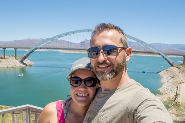
Roosevelt Damn Bridge at the end of the Apache Trail
Happy adventuring!
